 |
| Etna Flooding Case Study |
|


|
    
|
|
|
| |
|
Introduction
This lesson explores flooding, its causes, mitigation and other factors. Flooding is the largest natural hazard in Pennsylvania and in most of the states. To illustrate the issues surronding flooding, we employ a case study centered around the Borough of Etna, Pennsylvania. We then look at other types and locations where flooding is common.
|
| Definition: |
Flood:
An overflow or inundation that comes from a river or other body of water and causes or threatens damage. Any relatively high streamflow overtopping the natural or artificial banks in any reach of a stream.
Source: US Geological Service Kansas Water Science Center.
|
|
| |
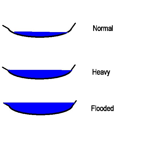
| The simulation below shows a typical waterway, in this case a creek, and the process by which it floods. Under normal conditions the water level is low in the creek basin. For different weather conditions the water level fluctuates significantly. Erosion from this fluctuation gives the waterway its characteristic basin structure. When rain or melting snow occurs, runoff finds its way into the waterway and the water level rises. If the added water is large enough, the waterway overflows its banks and flooding occurs. |
 |
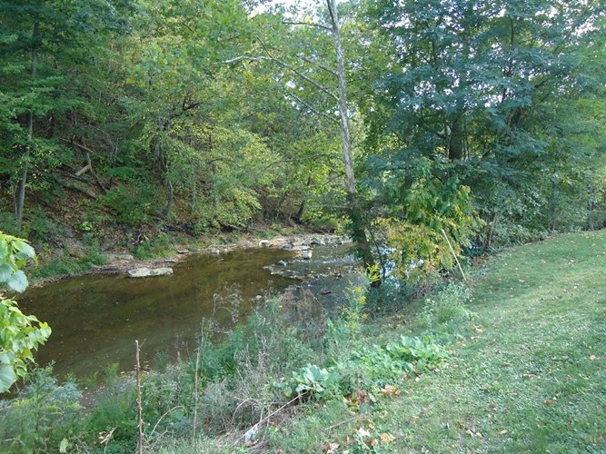
| The picture below shows Pine Creek just north of Etna, Pennsylvania. As one can see, It is structurally quite similar to the model above. As pictured, the water in the creek is flowing under normal conditions. |
| |
 |
| |
|
Etna, Pennsylvania
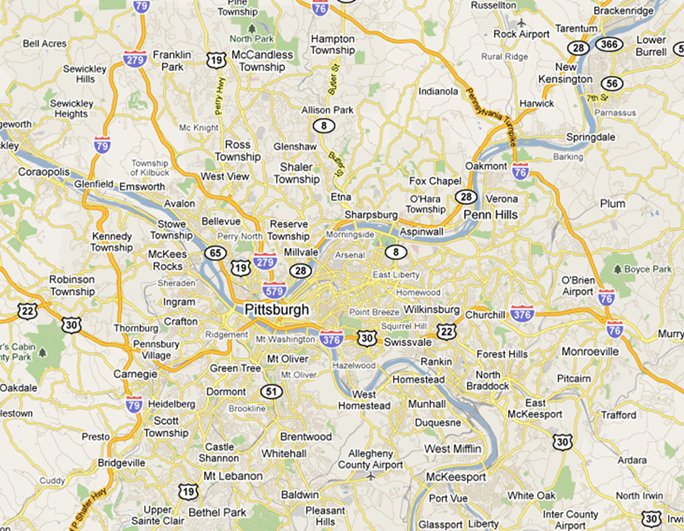
The map below shows the location of the Borough of Etna located about 10 miles northeast of Pittsburgh Pennsylvania along the Allegheny River. Etna is a community founded during the heyday of the steel industry. Its population of approximately 4000 residents is down considerably from the post World War II steel boom era. |
| |
 |
| |
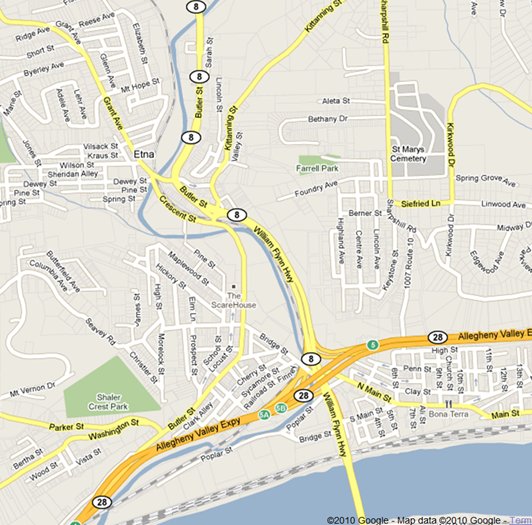
The next map shows a zoom in of the previous map with Etna as its center. As one can see Etna is situated alond the Allegheny River at the point where Pine Creek one of the Allegheny tributaries, passes.
Pennsylvania Route 28, a major highway, and Pennsylvania Route 8, which passes over Pittsburgh's 62nd street bridge, intersect in Etna. Major Norfolk Southern rail lines parallel both Routes 8 and 28.
The town also has some historical significance in that George Washington passed through Etna on his way from Pittsburgh to Fort LeBoeuf in Erie. |
| |
 |
| |
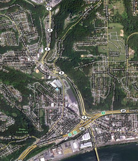
| The image below is identical to the above map overlaid with the satellite image for the area. The image is clickable. Clicking on the image will launch the Google map for Etna. |
| |
 |
|
| |
| Exercise: |
Click on the aerial image above to access the Google Map for Etna. The map has a marker at the intersection of Route 8 and Kittaning Street. Use the StreetView feature to follow Route 8 north to Saxonburg Boulevard. Note the locations of Pine Creek and the topography of the area. |
|
| |
|
| |
|
|
|
|
| Copyright © 2011 - 2014 Ken Sochats |